Exploring Hiking Trails in Vancouver: What You Need to Know
We thoroughly test and research all the services we review, ensuring you get reliable and trustworthy advice. Sometimes, all we need is an escape from the city.
While a walk in Stanley Park is nice, there’s something special about hiking through lush forests, surrounded by the sounds of nature. We love exploring Vancouver’s beautiful trails and want to share our favorites with you.
Ready to join us? Let’s go!
Most Popular Guides
- The Ultimate Birthday Party Checklist (Step-by-step)
- Kids Birthday Parties: The Ultimate Guide for Parents
- 50 Kids Party Food Ideas (Budget-Friendly)
- 50 Best Kids Birthday Party Ideas (Budget-Friendly)
- 50 Fun Birthday Party Themes for Kids
- Birthday Party Places for Kids: The Ultimate List for Any Budget
Top Hiking Trails in Vancouver
1. Sasamat Trail

- Difficulty: Easy
- Average Hiking Time: 41 minutes
- Address: Sasamat Trail (22), Vancouver, BC V6N 2C4, Canada
- Parking: Yes (CAD 2 per hour)
We discovered Sasamat Trail in Port Moody’s Belcarra Regional Park. This easy, well-kept trail features wide paths and minimal elevation changes, making it perfect for a leisurely hike. There are stairs in some areas, and plenty of trees and ferns to admire. Dogs are frequent visitors here, adding to the charm. The highlight? A refreshing dip in Sasamat Lake after your hike. Swimming and kayaking are also popular activities—just remember to bring your own canoe.
How to Get There:
- Head to Hastings Street and take East to Burnaby.
- Follow the Barnett Highway to Port Moody.
- Take St. John’s Street and turn left onto Ioco Road.
- Turn right onto 1st Avenue, then follow signs to Sasamat Lake and White Pine Beach.
2. Fraser River Trail
- Difficulty: Easy
- Average Hiking Time: 2 hours and 39 minutes
- Address: Vancouver, BC V5S 4V7, Canada
- Parking: Yes (Free)
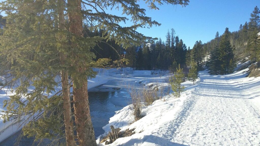
Located at the south end of Byrne Road, the Fraser River Trail offers ample parking but limited public transit options. The trail starts with a paved path shared with bikers before transitioning to an unpaved nature conservation area. The flat trail is perfect for enjoying scenic views of the Fraser River and observing wildlife. Amenities include picnic benches, restrooms, water fountains, and a playground.
How to Get There:
- From downtown Vancouver, take Granville Street and BC-99 to W 49th Avenue.
- Turn left onto Macdonald Street near McCleery Park.
- Continue to Celtic Avenue.
3. Salish Trail
- Difficulty: Moderately Challenging
- Average Hiking Time: 1 hour and 38 minutes
- Address: Pacific Spirit Regional Park, Vancouver, BC V6N 2C4, Canada
- Parking: Yes (Free)
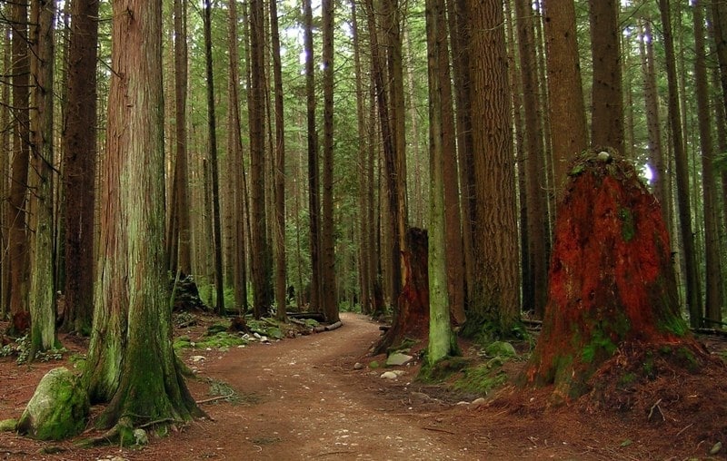
Salish Trail in Pacific Spirit Regional Park is a tranquil escape from city life. The wide, well-marked trails offer plenty of tree coverage, making it a great choice even on rainy days. There’s minimal elevation change, so it’s an easy walk despite the moderately challenging label.
How to Get There:
- Start at 16th Avenue near Camosun Park.
- From downtown Vancouver, drive south over the Granville Street bridge to 16th Avenue.
- Turn right and continue to Camosun Park.
4. Stawamus Chief Trail
- Difficulty: Intermediate
- Average Hiking Time: 4 to 5 hours
- Address: Garibaldi Highlands, BC V0N 1T0, Canada
- Parking: Yes (Free)
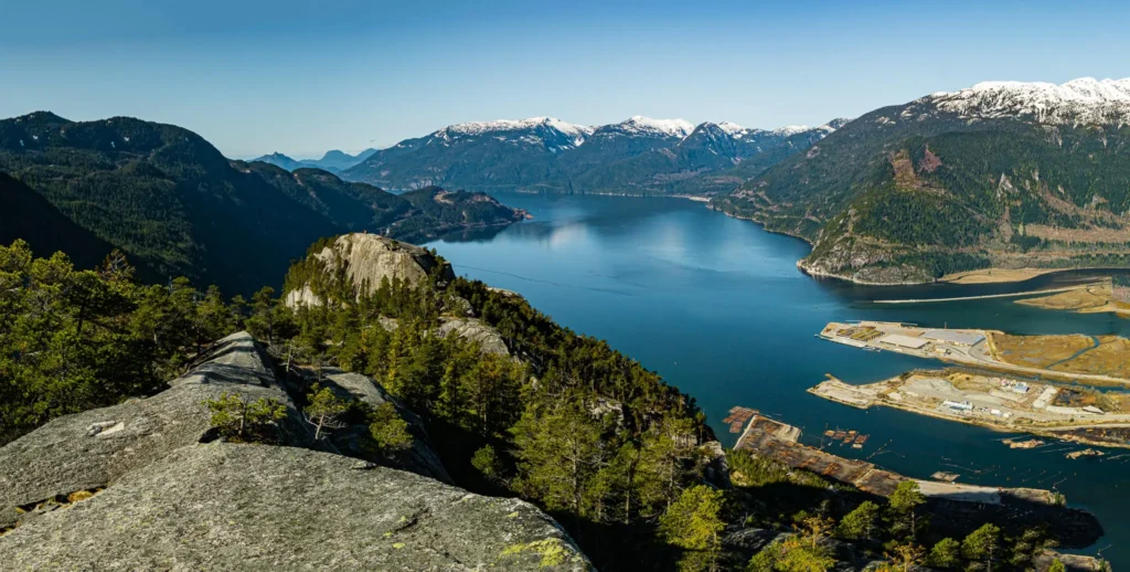
Stawamus Chief Trail is a breathtaking hike with exposed tops, offering stunning mountain views. This moderate to hard trail involves climbing narrow ladders, so bring water and energy snacks. The effort is worth it for the spectacular summit views. Be cautious of slippery conditions if it’s raining.
How to Get There:
- Take Highway #1 westbound towards Horseshoe Bay.
- Continue on the Sea to Sky Highway to Shannon Falls.
- Exit near the Sea to Sky Gondola parking lot and turn right.
- Park near the trailhead at the south end of the parking lot.
5. Mahon Park
- Difficulty: Easy
- Average Hiking Time: 2 hours
- Address: 1648 Jones Avenue, North Vancouver V7M, BC, CA
- Parking: Yes (Free)
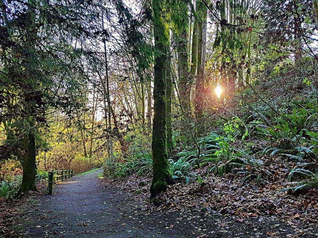
Mahon Park offers a balanced hike with plenty of stairs, small inclines, hills, and streams. Located near Carson Graham High School in North Vancouver, it’s easily accessible with ample parking. This trail is perfect for those seeking a moderate hike with beautiful nature.
How to Get There:
- Take the BC-1A to Marine Drive in West Vancouver.
- Drive towards Marine Drive Exit, then continue to Wolfe Street in North Vancouver.
6. Capilano Canyon
- Difficulty: Moderately Challenging
- Average Hiking Time: 2 hours
- Address: 5077 Capilano Rd, North Vancouver, BC V7R 4K4, Canada
- Parking: Yes (Free)
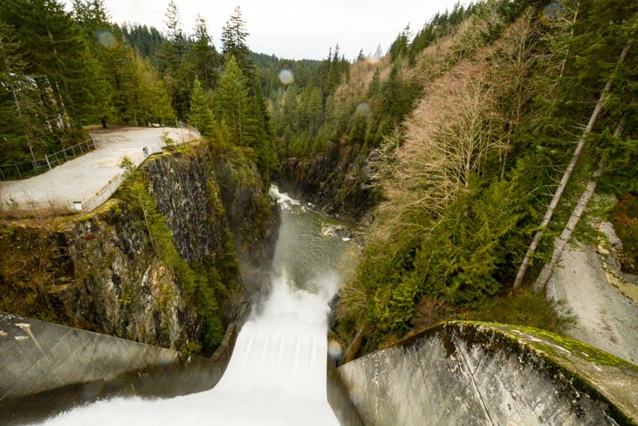
Capilano Canyon offers stunning views of mountains, the Capilano River, and Cleveland Dam. Suitable for all skill levels, the trail features some steep slopes. Enjoy a picnic before starting your hike, and don’t miss the Capilano Salmon Hatchery.
How to Get There:
- Head west along Georgia Street and drive towards the Stanley Park Causeway.
- Cross the Lions Gate Bridge, then turn onto Capilano Road.
- Pass the Capilano Suspension Bridge and Salmon Hatchery, then follow signs to Cleveland Dam.
7. Lighthouse Park
- Difficulty: Easy
- Average Hiking Time: 1 hour and 57 minutes
- Address: 4902 Beacon Ln, West Vancouver, BC V7W 1K5, Canada
- Parking: Yes (Free)
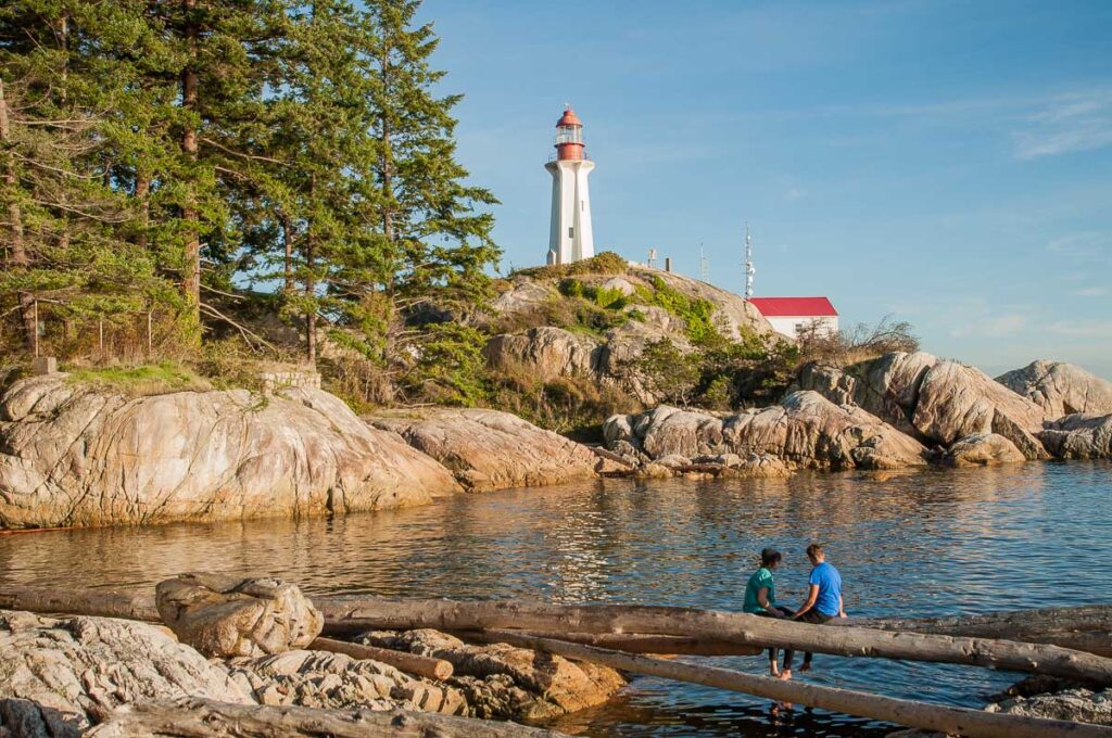
Lighthouse Park provides an easy, family-friendly hike with stunning ocean and city views. Explore various trails through the woods and be cautious of slippery rocks at the shore. Arrive early to avoid crowds and secure a parking spot.
How to Get There:
- Drive towards Marine Drive in West Vancouver.
- Pass Caufield Cove marina and follow signs for Lighthouse Park.
- Turn left on Beacon Lane and continue to the parking lot.
8. Grouse Grind

- Difficulty: Moderately Difficult
- Average Hiking Time: 2 hours and 30 minutes
- Address: 6400 Nancy Green Way, North Vancouver, BC V7R 4K9
- Parking: Yes (CAD 10 all-day parking)
Grouse Grind is a challenging 2.9-kilometer trail known as “Mother Nature’s Stairmaster.” Climb 2,830 stairs to reach Grouse Mountain’s summit. The steep trail and high elevation gain make it a tough hike, but the panoramic views of Vancouver are worth it.
How to Get There:
- From downtown Vancouver, follow BC-1A and take Capilano Road to Nancy Greene Way in North Vancouver.
- Continue driving on Nancy Greene Way to Grouse Mountain.
9. Camosun Bog
- Difficulty: Easy
- Average Hiking Time: 26 minutes
- Address: Imperial Dr, Vancouver, BC, Canada
- Parking: Yes (Free)
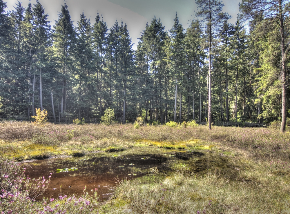
Camosun Bog offers a short, informative hike with many signs detailing the plants and animals in the bog. This ancient wetland, over 3,500 years old, is well-maintained and provides a peaceful, educational experience.
How to Get There:
- Take Howe Street and W 16th Avenue to Crown Street.
- Continue driving on Crown Street, make a left, and you’ll reach Camosun Bog.
10. Hyannis Trail
- Difficulty: Easy
- Average Hiking Time: 42 minutes
- Address: Hyannis Trail, North Vancouver, BC V7H 2Z2, Canada
- Parking: Yes (Free)
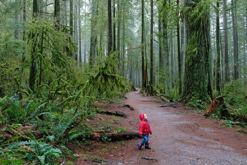
Hyannis Trail is a smooth, wide, and flat path lined with tall, old-growth trees. Ideal for a leisurely hike, it’s easy to navigate and shares the trail with bikers. Enjoy the tranquility and natural beauty, even on rainy days.
How to Get There:
- From downtown Vancouver, take W Cordova Street to the Cordova Diversion.
- Drive onto Powell Street and head towards Dundas Street.
- Turn left onto Nanaimo Street, then continue to McGill Street.
- Take the Trans Canada Highway and Mount Seymour Parkway Exit 22B.
- Follow signs to Berkley Road, then Hyannis Drive where you can park.
